It’s Getting Active: Hurricane Gustav, Hurricane Hanna, Tropical Storm Ike-Spaghetti Models, Radar, Forecast Track…you name it we got it
September 1, 2008

NHC Atlantic Overview 5pm 0901

NHC Atlantic Overview 5pm 0901

For an interactive radar which you can create a Hurricane Gustav Radar Loop or make a Hurricane Hanna Radar Loop as it approaches, CLICK HERE.  Simply navigate to whatever location you like. It goes to street level mapping and has a looping feature (animate) and you can add clouds and lightning.

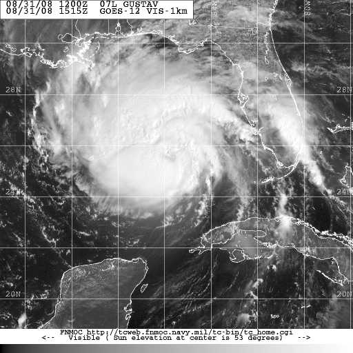
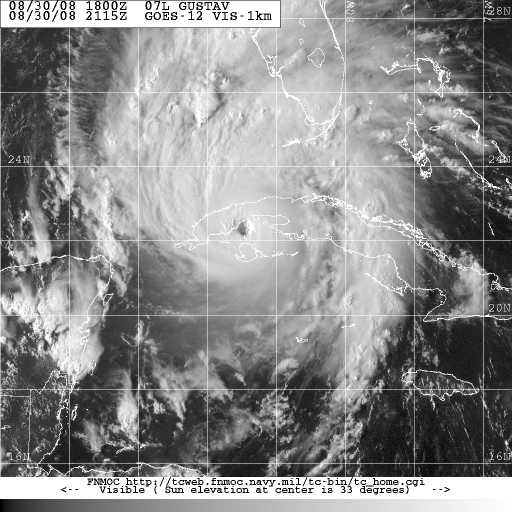
The tropics are getting quite active as indicated above.  We have Hurricane Gustav dying out. But, I’ll tell you what…I still think that we got lucky ole Gustav ran out of water.  It looks pretty impressive and symmetrical over Central Louisiana. We have Hurricane Hanna. We have Tropical Storm Ike and a very strong tropical wave coming off of Africa as well as two other characters out there.  So, we’ll be long on graphics and short on commentary this time around. 

Hurricane Gustav Forecast Track 5pm 0901

Hurricane Gustav Forecast Track 5pm 0901

Gustav: National Hurricane Center did one of the best jobs I’ve ever seen on the

Hurricane Gustav Spaghetti Model 0901 18Z

Hurricane Gustav Spaghetti Model 0901 18Z

forecast track. It went almost exactly where they said it would 72 hours and 1000 miles out.  It will be a big rain maker in East Texas and Louisiana.  It’s gonna stall out and produce up to 2 feet of rain in spots.  We in Louisville would like some rain from Gustav and  a front is coming down that will pick up the moisture. But around the time the front gets here at the end of the week, Hurricane Hanna will be making landfall somewhere on the Southeast Coast.  The dry air being drawn down from the northeast and sinking

5 Day Rainfall Forecast Through Sat AM

5 Day Rainfall Forecast Through Sat AM

air ahead of the storm should suppress the rain around the Ohio Valley.  Notice the rain amounts on the 5 day rainfall forecast for that from Gustav and from Hanna and the big donut hole over the Ohio Valley.  That happens quite often around here this time of year.  Then Hanna moves up the east coast and behind it in the Bahamas comes what will likely be Hurricane Ike.

Below are reports from between 4 am and 4:30 am on Monday for the Pilot House near Southwest Pass which basically is the mouth of the Mississippi River well South of New Orleans.  Numbers are in knots so you see they had sustained winds for a time near 90 mph with gusts to 115 mph.

09 01 4:30 am ESE 75.0 94.0 – – – – 28.85 – 78.4 90.9 – – – –
09 01 4:24 am E 74.0 94.0 – – – – 28.86 – 78.3 90.9 – – – –
09 01 4:18 am E 79.1 100.0 – – – – 28.87 – 78.1 90.9 – – – –
09 01 4:12 am E 75.0 93.0 – – – – 28.87 – 77.9 90.9 – – – –
09 01 4:06 am – 75.0 102.0 – – – – 28.89 – 77.9 90.9 – – – –
09 01 4:00 am E 75.0 96.0 – – – – 28.91 -0.51 77.9 90.9 – – – –

Here is the National Hurricane Center for Hurricane Hanna as well as Hurricane Hanna Spaghetti Models and Forecast Track… Followed by the National Hurricane Center Tropical Storm Ike Discussion with the corresponding Forecast Track and Tropical Storm Ike Spaghetti model.

HURRICANE HANNA DISCUSSION NUMBER  20
NWS TPC/NATIONAL HURRICANE CENTER MIAMI FL   AL082008
500 PM EDT MON SEP 01 2008

Hurricane Hanna NHC Forecast Track 5pm 0901

Hurricane Hanna NHC Forecast Track 5pm 0901

THE AIR FORCE RECONNAISSANCE AIRCRAFT RECENTLY FOUND A CENTRAL
PRESSURE OF 983 MB AND A PEAK FLIGHT LEVEL WIND OF 89 KT.  THESE
NUMBERS INDICATE HANNA HAS CONTINUED TO STRENGTHEN IN THE FACE OF
WHAT APPEARS TO BE STRONG NORTHERLY SHEAR…AND THE INITIAL
INTENSITY IS INCREASED TO 70 KT.  THE INTENSITY FORECAST REMAINS
DIFFICULT SINCE GLOBAL MODES SHOW THE SHEAR REMAINING STRONG OR
POSSIBLY INCREASING DURING THE NEXT COUPLE OF DAYS.  GIVEN HANNA’S
TENACITY THUS FAR…THE OFFICIAL FORECAST PRESUMES THAT HANNA WILL
BE ABLE TO FIGHT OFF THE SHEAR.  AT DAY 5…HANNA IS FORECAST TO BE
INLAND SO WEAKENING IS SHOWN. 

Hurricane Hanna Spaghetti Model 0901 18Z

Hurricane Hanna Spaghetti Model 0901 18Z

THE LAST FEW FIXES FROM THE AIRCRAFT INDICATE THAT HANNA HAS BEEN
MEANDERING.  HOWEVER…A 12-HOUR AVERAGE MOTION IS SOUTH-
SOUTHWESTWARD AT ABOUT 4 KT AND THIS WILL BE THE INITIAL MOTION
ESTIMATE.  WITH THE SUBTROPICAL RIDGE NORTH OF HANNA NOW
DISSIPATED…THE CYCLONE’S MOTION DURING THE NEXT COUPLE OF DAYS IS
EXPECTED TO BE SLOW AND POSSIBLY ERRATIC.   AFTER THAT…GLOBAL
MODELS SHOW THE SUBTROPICAL RIDGE BUILDING BACK OVER THE
WEST-CENTRAL ATLANTIC…AND THIS SHOULD CAUSE HANNA TO TURN
NORTHWEST WITH AN INCREASE IN FORWARD SPEED.  THERE IS STILL SOME
SPREAD AMONG THE VARIOUS TRACK MODELS WITH POTENTIAL AREAS OF
IMPACT RANGING FROM SOUTH FLORIDA THROUGH THE CAROLINAS.  UNTIL
HANNA TAKES A MORE DEFINITIVE MOTION…IT WILL BE DIFFICULT TO BE
MORE SPECIFIC ABOUT THE POTENTIAL THREAT AREA.  ALL INTERESTS ALONG
THE SOUTHEASTERN UNITED STATES COASTS SHOULD MONITOR THE PROGRESS
OF THIS SYSTEM.

Hurricane Hanna Spaghetti Model Intensity Graph 0901 18Z

Hurricane Hanna Spaghetti Model Intensity Graph 0901 18Z

FORECAST POSITIONS AND MAX WINDS

INITIAL      01/2100Z 22.2N  72.6W    70 KT
12HR VT     02/0600Z 21.9N  72.9W    75 KT
24HR VT     02/1800Z 21.8N  73.5W    75 KT
36HR VT     03/0600Z 22.1N  73.9W    75 KT
48HR VT     03/1800Z 23.1N  74.5W    75 KT
72HR VT     04/1800Z 27.0N  78.0W    85 KT
96HR VT     05/1800Z 31.5N  81.0W    85 KT
120HR VT     06/1800Z 39.0N  80.5W    25 KT…INLAND

$$
FORECASTER RHOME/AVILA

TROPICAL STORM IKE DISCUSSION NUMBER   2
NWS TPC/NATIONAL HURRICANE CENTER MIAMI FL   AL092008
500 PM EDT MON SEP 01 2008

Tropical Storm Ike NHC Forecast Track 5pm 0901

Tropical Storm Ike NHC Forecast Track 5pm 0901

SATELLITE IMAGES THAT THE CLOUD PATTERN ASSOCIATED WITH THE
DEPRESSION HAS CONTINUED TO BECOME BETTER ORGANIZED. THE CONVECTION
HAS INCREASED…CURVED BANDS ARE BECOMING MORE DISTINCT
AND THE OUTFLOW IS FAIR IN ALL QUADRANTS. DVORAK T-NUMBERS FROM
TAFB AND SAB HAVE INCREASED TO 3.0 ON THE DVORAK SCALE. ON THIS
BASIS…THE SYSTEM HAS BEEN UPGRADED TO TROPICAL STORM IKE WITH AN
INITIAL INTENSITY OF 45 KNOTS.  GIVEN THE WARM OCEAN ALONG ITS PATH
AND THE LOW SHEAR…IKE IS FORECAST TO REACH HURRICANE STATUS IN
ABOUT 36 HOURS. THE RATE OF STRENGTHENING IS CONSISTENT WITH THE
SHIPS MODEL GUIDANCE BUT MUCH LOWER THAN THE GFDL AND SIGNIFICANTLY
LOWER THAN THE HWRF. THE LATTER MAKES IKE AN INTENSE HURRICANE
NORTH OF HISPANIOLA.

Tropical Storm Ike Spaghetti Model 0901 18Z

Tropical Storm Ike Spaghetti Model 0901 18Z

IKE IS MOVING TOWARD THE WEST OR 275 DEGREES AT 14 KNOTS. THE STORM
IS ALREADY LOCATED SOUTH OF A STRONG SUBTROPICAL RIDGE WHICH IS
BUILDING AND EXPANDING WESTWARD ACCORDING TO MOST OF THE GLOBAL
MODELS. THIS PATTERN CALLS FOR A GENERAL WEST TO WEST-NORTHWEST
TRACK FOR THE NEXT 2 TO 3 DAYS. THEREAFTER…AS THE HIGH BUILDS
FARTHER WESTWARD…THE CYCLONE COULD TURN MORE TO THE WEST OR EVEN
WEST-SOUTHWEST . THE OFFICIAL FORECAST IS VERY SIMILAR TO THE
PREVIOUS ONE AND FOLLOWS THE MODEL CONSENSUS. SINCE THE TRACK
GUIDANCE CONTINUES TO BE RATHER TIGHT…THE FORECAST CONFIDENCE
REMAINS RELATIVELY HIGH.

Tropical Storm Ike Spaghetti Model Intensity Graph 0901 18Z

Tropical Storm Ike Spaghetti Model Intensity Graph 0901 18Z

FORECAST POSITIONS AND MAX WINDS

INITIAL      01/2100Z 17.7N  40.6W    45 KT
12HR VT     02/0600Z 18.0N  42.8W    50 KT
24HR VT     02/1800Z 18.5N  45.5W    60 KT
36HR VT     03/0600Z 19.5N  48.5W    70 KT
48HR VT     03/1800Z 20.5N  51.5W    75 KT
72HR VT     04/1800Z 21.5N  58.0W    80 KT
96HR VT     05/1800Z 22.0N  64.0W    80 KT
120HR VT     06/1800Z 22.0N  69.5W    80 KT

$$
FORECASTER AVILA

Hurricane Gustav Making Landfall and Slowing Down; Two More Storms
September 1, 2008

for a more recent update on Hurricane Gustav, Hurricane Hanna and Tropical Storm Ike, CLICK HERE

For a Radar Loop to track Hurricane Gustav, CLICK HERE. You can navigate anywhere in the country to street level. The image can be looped with clouds and lightning added.

Hurricane Gustav NHC forecast Track 11AM 0901

Hurricane Gustav NHC forecast Track 11AM 0901

Hurricane Gustav made landfall about 70 miles SW of New Orleans and 100 miles SE of Lafayette. Pretty close to Houma. The structure got fairly decent and the

Hurricane Gustav Spaghetti Model 0901 12Z

Hurricane Gustav Spaghetti Model 0901 12Z

pressure was at a level that could have supported higher winds, but the satellite photo indicates to me that the dry air that the hurricane hunter reported last night has worked into the center. So, while the pressure was still at 955 mb, the winds fell just prior to landfall to 110 mph and is moving NW at 15 mph. If you want to play the category game, it was a Cat 2 at landfall….if it had stayed 5 mph stronger, it would have been a Cat 3. I sometimes think this “what category is it?” stuff is silly. Anyway, it still remains to be seen how the water piling up into Lake Borgne will affect the Intercoastal Waterway and Industrial Canal. However, cautiously it would appear the distance from New Orleans and the lesser strength was sufficient to keep the storm surge rather manageable in New Orleans. But, they thought that about Katrina too. The reporters were in the French Quarter saying that “we dodged a bullet” when the east side of town had been under water for 6 hours. I suspect that the levees will be under pressure and perhaps even topped to some degree but probably not to the degree of Katrina. On Sunday evening, it was interesting that while the central winds were not that great, the hurricane force winds were somewhat broad and that seems to be holding true with winds in MIssissippi running close to hurricane force. There may be a lot of tornados with this one, but one cannot really tell for certain.

Gustav Rain Forecast 120 hours

Gustav Rain Forecast 120 hours

The boys at the National Hurricane Center have done a great job as the track went almost exactly as forecast for several days. Despite the variables, the track is pretty much running up the eastern side of Vermilion Bay toward Fort Polk. It is still anticipated to slow to a crawl in west Louisiana. Rainfall will be excessive. The main difference between this and Fay is that the upper support is anticipated to be chopped off in the next few days. That probably won’t limit the rainfall, but should limit the winds a bit and also prevent the storm from being as long lived as Fay.

Tropical Storm Hanna Forecast Track 11AM 0901

Tropical Storm Hanna Forecast Track 11AM 0901

Tropical Storm Hanna is getting better organized. It is expected to approach

Tropical Depression 9 Forecast Track 0901 11AM

Tropical Depression 9 Forecast Track 0901 11AM

minimal hurricane status and loop through the Bahamas, along the east coast of Florida and into Georgia or South Carolina and then up the east coast. However, the most recent path of toward the SW is rather interesting and is not part of the plan and looks similar to the track from a few days ago when the data supported a run down and around into the Gulf. Stay tuned. A tropical Depression has also formed and and is expected to increase in intensity. There are also other areas of interest in the Atlantic. Here is the National Hurricane Center Gustav Discussion for 11AM Monday:

HURRICANE GUSTAV DISCUSSION NUMBER  32
NWS TPC/NATIONAL HURRICANE CENTER MIAMI FL   AL072008
1100 AM EDT MON SEP 01 2008

THE CENTER OF GUSTAV MADE LANDFALL ALONG THE LOUISIANA COAST NEAR
COCODRIE ABOUT 1430 UTC.  DURING THE PAST FEW HOURS...THE EYE
BECAME BETTER DEFINED ON RADAR.  HOWEVER...WIND DATA FROM AIR FORCE
RESERVE AND NOAA AIRCRAFT ALONG WITH DOPPLER RADAR WINDS SUGGESTS
THAT GUSTAV WEAKENED TO A CATEGORY TWO HURRICANE BEFORE LANDFALL.
THE INITIAL INTENSITY OF 95 KT IS BASED ON THE AIRCRAFT DATA...AND
THIS MIGHT BE A LITTLE GENEROUS.

THE INITIAL MOTION IS 310/13.  GUSTAV IS BEING STEERED NORTHWESTWARD
BY A MID-LEVEL RIDGE OVER THE EASTERN UNITED STATES.  THE CYCLONE
IS EXPECTED TO CONTINUE NORTHWESTWARD WITH A DECREASE IN FORWARD
SPEED AS A LOW-LEVEL RIDGE BUILDS TO THE THE NORTH AND NORTHWEST.
THE FORECAST TRACK IS ESSENTIALLY AN UPDATE OF THE PREVIOUS
FORECAST THROUGH 48 HR.  AFTER THAT TIME...THE GUIDANCE IS NOW IN
BETTER AGREEMENT ON A SLOW NORTHWARD MOTION...SO THE 72-120 HR PART
OF THE TRACK IS CHANGED FROM A WESTWARD DRIFT TO A NORTHWARD DRIFT.

GUSTAV SHOULD WEAKEN AS IT MOVES INLAND...ALTHOUGH THE WEAKENING
WILL LIKELY BE SLOW AT FIRST AS THE CENTER CROSSES THE SOUTH
LOUISIANA MARSHES.  A FASTER WEAKENING IS EXPECTED IN 6-12 HR AS
THE CENTER REACHES MORE SOLID GROUND.  AFTER 48 HR...GUSTAV IS
LIKELY TO SHEAR APART...WITH THE UPPER-LEVEL PORTION OF THE CYCLONE
MOVING NORTHEASTWARD AND LEAVING THE SURFACE CENTER BEHIND.
THUS...THE FORECAST SHOWS THE SYSTEM BECOMING A REMNANT LOW BY 72
HR.

THE THREAT OF HIGH STORM SURGE WILL CONTINUE ALONG THE LOUISIANA
COAST FOR SEVERAL MORE HOURS...AND THE THREAT OF HEAVY RAINS WILL
CONTINUE FOR SEVERAL DAYS.

FORECAST POSITIONS AND MAX WINDS

INITIAL      01/1500Z 29.2N  90.8W    95 KT
 12HR VT     02/0000Z 30.3N  92.4W    70 KT...INLAND
 24HR VT     02/1200Z 31.3N  93.8W    40 KT...INLAND
 36HR VT     03/0000Z 31.9N  94.6W    30 KT...INLAND
 48HR VT     03/1200Z 32.4N  95.3W    25 KT...INLAND
 72HR VT     04/1200Z 33.0N  95.5W    20 KT...INLAND REMNANT LOW
 96HR VT     05/1200Z 33.5N  95.5W    20 KT...INLAND REMNANT LOW
120HR VT     06/1200Z 34.0N  95.5W    20 KT...INLAND REMNANT LOW

$$
FORECASTER BEVEN

Hurricane Gustav Spaghetti Models Shifting West But Forecast Track Still Relatively Unchanged
August 31, 2008

for a more recent update on Gustav, CLICK HERE

For Access to a Radar that allows you to track Gustav as it approaches the US by zooming in to street level, making a radar loop, put in clouds and lighting, CLICK HERE. It will default to the Ohio Valley, but simply navigate it to the Gulf Coast or anywhere else in the nation.

Check out the Report from some ship that found itself in Gustav in the Gulf of Mexico….that’s 60 knot winds and 45.9 foot seas.  Hope they took their dramamine.

ID      T1 TIME    LAT     LON     DIST   HDG   WDIR    WSPD     GST    WVHT  

SHIP   S 1800   27.80  -86.00  150   0     50       60.0     –    45.9 

Hurricane Gustav NHC Forecast Track 5 PM 0831

Hurricane Gustav NHC Forecast Track 5 PM 0831

Hurricane Gustav is behaving a bit oddly as it moves along.  It has picked up speed.  It is trying to get itself together as more convection is blowing up and

Hurricane Gustav Intensity Probability Table 0831 5PM

Hurricane Gustav Intensity Probability Table 0831 5PM

pressures continue to fall, at 5pm down to 957 mb.  But, the wind remains at 115 mph, the convection is not symmetrical around the center, the eye is ill-formed and often with an open quadrant and the outflow to the south remains poor .  The forecast is for a landfall wind intensity of around 130 mph with higher gusts.  The storm surge is projected at 10-15 feet but I still wonder about the water piling up in Lake Borgne.  The track though remains in question.  As I have been pondering for several days, the track may still be a bit west of the current forecast

Hurricane Gustav Spaghetti Model 0831 18Z

Hurricane Gustav Spaghetti Model 0831 18Z

track.  Correspondingly, the NHC has extended the Hurricane Warning all the way to High Island, east of Galveston.  The Spaghetti models have numerous models taking the track farther west to the west side of Vermillion Bay. A few still want to

Hurricane Gustav Spaghetti Model Intensity graph 0831 18Z

Hurricane Gustav Spaghetti Model Intensity graph 0831 18Z

take it farther east.  This is still a formidable storm and the weakening of the system should be of great relief, but it will still be a dangerous, life-threatening storm.  It will get stuck inland over east Texas and rain fall of 1-2 feet is possible inland.

Here is the National Hurricane Center 5pm Hurricane Gustav Discussion:

HURRICANE GUSTAV DISCUSSION NUMBER  29
NWS TPC/NATIONAL HURRICANE CENTER MIAMI FL   AL072008
500 PM EDT SUN AUG 31 2008

VISIBLE SATELLITE IMAGERY DURING THE PAST COUPLE OF HOURS SUGGESTS
THAT GUSTAV IS GETTING A LITTLE BETTER ORGANIZED…WITH A HINT OF
AN EYE RETURNING.  ADDITIONALLY…THE CENTRAL PRESSURE REPORTED BY
AN AIR FORCE RESERVE HURRICANE HUNTER HAS FALLEN TO 957 MB.  ON THE
OTHER HAND…THE MAXIMUM 700 MB FLIGHT-LEVEL WINDS WERE 105 KT WHILE
THE MAXIMUM SFMR WINDS WERE 93 KT.  ALSO…THE CONVECTION…WHILE
VIGOROUS…IS STILL RATHER ASYMMETRIC AROUND THE 30 NM WIDE EYE
THAT IS OPEN TO THE SE.  BASED ON THE AIRCRAFT DATA…THE INITIAL
INTENSITY IS LOWERED TO 100 KT.

THE INITIAL MOTION IS WOBBLING BETWEEN 315 AND 320 DEGREES AT 15-16
KT…WITH 320/16 BEING THE ADVISORY MOTION.  THERE IS NO CHANGE IN
THE TRACK FORECAST PHILOSOPHY…WITH A
MID-LEVEL RIDGE OVER THE EASTERN UNITED STATES EXPECTED TO STEER
GUSTAV NORTHWESTWARD INTO THE NORTHERN GULF COAST.  THE NEW
GUIDANCE RUNS…MOST NOTABLY THE HWRF…SHOW A SLIGHT LEFT TURN
AFTER 12 HR WITH A LEFTWARD SHIFT IN THE LANDFALL POINT ON THE
LOUISIANA COAST.  THE NEW FORECAST TRACK IS SHIFTED SLIGHTLY TO THE
LEFT OF THE PREVIOUS TRACK…AND SINCE IT LIES NEAR THE EASTERN
EDGE OF THE GUIDANCE ENVELOPE SOME ADDITIONAL SMALL SHIFTS MAY BE
NECESSARY LATER.  AFTER 48-72 HR…THERE REMAINS MAJOR DISAGREEMENT
BETWEEN THE DYNAMICAL MODELS ON WHETHER GUSTAV WILL RECURVE INTO
THE WESTERLIES…SHEAR APART AND STALL OVER LOUISIANA OR TEXAS…OR
TURN SOUTHWESTWARD.  THE FORECAST TRACK AFTER 72 HR FOLLOWS THE
SHEAR-APART-AND-STALL SCENARIO…CALLING FOR GUSTAV TO MOVE SLOWLY
WESTWARD AS IT WEAKENS OVER LAND.

ANALYSES FROM CIMSS AT THE UNIVERSITY OF WISCONSIN INDICATE THAT
GUSTAV REMAINS IN ABOUT 20 KT OF SOUTHERLY SHEAR…WITH A LOT OF
MID/UPPER-LEVEL DRY AIR SEEN IN WATER VAPOR IMAGERY SOUTH AND WEST
OF THE CYCLONE.  THE EYE HAS MOVED NORTHWEST OF THE DEEP WARM WATER
OF THE LOOP CURRENT…AND THAT COMBINED WITH THE LIKELIHOOD OF
CONTINUED SHEAR REDUCES THE CHANCES OF SIGNIFICANT INTENSIFICATION.
THE SHIPS MODEL FORECASTS NO STRENGTHENING BEFORE LANDFALL…WHILE
THE GFDL AND HWRF FORECAST ABOUT 10 KT OF STRENGTHENING.  GIVEN THE
FALLING PRESSURES AND THE COLD CONVECTION…THE INTENSITY FORECAST
CALLS FOR WINDS TO INCREASE TO 110 KT BEFORE LANDFALL…WITH GUSTAV
MAKING LANDFALL AS A MAJOR HURRICANE.  GUSTAV SHOULD WEAKEN AFTER
LANDFALL AND BECOME A REMNANT LOW IN ABOUT 120 HR.

FORECAST POSITIONS AND MAX WINDS

INITIAL      31/2100Z 26.4N  87.3W   100 KT
12HR VT     01/0600Z 27.9N  88.9W   110 KT
24HR VT     01/1800Z 29.4N  90.9W   100 KT…INLAND
36HR VT     02/0600Z 30.7N  92.7W    60 KT…INLAND
48HR VT     02/1800Z 31.5N  93.9W    35 KT…INLAND
72HR VT     03/1800Z 32.0N  95.0W    30 KT…INLAND
96HR VT     04/1800Z 32.0N  96.0W    25 KT…INLAND
120HR VT     05/1800Z 32.0N  96.5W    20 KT…INLAND REMNANT LOW

$$
FORECASTER BEVEN

Hurricane Gustav Still Dangerous But Not Quite As Ferocious
August 31, 2008

FOR A MORE RECENT UPDATE ON GUSTAV, CLICK HERE

To track Gustav as it approaches the US coast using a radar that you can navigate yourself (down to street level), CLICK HERE. It will default to the Ohio Valley but you can take it anywhere any time and make it loop (animate) put on clouds, lightning and even have some computer generated analysis.

Hurricane Gustav NHC Forecast Track 11AM 0831

Hurricane Gustav NHC Forecast Track 11AM 0831

Hurricane Warnings have been hoisted from Cameron, LA to east of Mobile. Winds at

Hurricane Gustav Intensity Probability Table 11AM 0831

Hurricane Gustav Intensity Probability Table 11AM 0831

11am were placed at 120 mph with a pressure rise to 962 mb. The storm continues to not recover well from its encounter with Cuba as the upper level environment has not been friendly. Modeling data is also coming around again to a slightly more western landfall.

Some of you may have noticed on the satellite imagery last night that the southern part of the outflow seemed to be missing. Well…that has been due to a shear with a sourtherly component. And in the NHC discussion, the indications are that a guidance model suggests that will persist. The storm is over warm water now and this is the time of the best opportunity for restrengthening so if its got its hat getting knocked off then the

Hurricane Gustav Spaghetti Model 0831 12Z

Hurricane Gustav Spaghetti Model 0831 12Z

opportunity may be slipping away. And, you will note that the shearing is forecast

Hurricane Gustav spaghetti model intensity graph 0831 12Z

Hurricane Gustav spaghetti model intensity graph 0831 12Z

my data to continue so the potential for an extraordinary storm is diminishing. That’s good given the current forcast track. As for that track, there are some indications that the track may indeed be farther west than the current forecast. The real consensus for the spaghetti model is back to along the eastern coast of Vermillion Bay. Tough road for Franklin, New Iberia and Lafayette. This storm will also prove problematic for inland concerns in western LA and East Texas as this guy will probably be a big rain maker as it lumbers along after landfall. The farther west it is, the better New Orleans will fare. This reduction in ferocity creates a different scenario possiby for New Orleans but the storm should still be considered to be dangerous, because it is. Here is the National Hurricane Center Gustav Forecast Discussion for 11AM:

HURRICANE GUSTAV DISCUSSION NUMBER 28

NWS TPC/NATIONAL HURRICANE CENTER MIAMI FL AL072008

1100 AM EDT SUN AUG 31 2008

GUSTAV CONTINUES TO LOOK SOMEWHAT RAGGED IN SATELLITE APPEARANCE THIS MORNING. THE DEEP CONVECTION IS VERY ASYMMETRIC…WITH THE COLD TOPS DUE MAINLY TO ONE HOT TOWER IN THE WESTERN EYEWALL. WHILE AN EYE-LIKE FEATURE IS APPARENT…IT IS DISPLACED TO THE NORTHEAST OF THE AIRCRAFT-REPORTED CENTER. THE LATEST REPORT FROM A NOAA HURRICANE HUNTER INDICATES THE CENTRAL PRESSURE HAS RISEN TO 962 MB…ALONG WITH AN ELLIPTICAL 30 BY 20 N MI WIDE EYE OPEN TO THE SOUTHEAST. THE INITIAL INTENSITY IS REDUCED TO 105 KT…AND THIS MIGHT BE A LITTLE GENEROUS BASED ON THE AIRCRAFT WINDS. THE INITIAL MOTION IS 320/15. THERE IS NO CHANGE IN THE FORECAST PHILOSOPHY FOR THE EARLY PORTION OF THE FORECAST TRACK…WITH A MID-LEVEL RIDGE OVER THE EASTERN UNITED STATES EXPECTED TO STEER GUSTAV NORTHWESTWARD INTO THE NORTHERN GULF COAST. THE NEW GUIDANCE RUNS SHOW A SLIGHT LEFT TURN AFTER 12 HR WITH A LEFTWARD SHIFT IN THE LANDFALL POINT ON THE LOUISIANA COAST. THE NEW FORECAST TRACK WILL NOT FOLLOW THIS SHIFT YET…AND THUS LIES NEAR THE EASTERN EDGE OF THE GUIDANCE ENVELOPE AND THE PREVIOUS FORECAST TRACK THROUGH 48 HR. AFTER 48-72 HR…THERE IS MAJOR DISAGREEMENT BETWEEN THE DYNAMICAL MODELS ON WHETHER GUSTAV WILL RECURVE INTO THE WESTERLIES…STALL OVER LOUISIANA OR TEXAS…OR TURN SOUTHWESTWARD. SINCE THIS KIND OF SPREAD FREQUENTLY PRECEDES SLOW MOTION…THE FORECAST TRACK WILL CALL FOR A SLOW WESTWARD MOTION AFTER 72 HR. AT THE RISK OF SOUNDING LIKE A BROKEN RECORD…THE INTENSITY FORECAST REMAINS PROBLEMATIC. ANALYSES FROM CIMSS AT THE UNIVERSITY OF WISCONSIN SHOWS THAT GUSTAV REMAINS IN 15 TO 20 KT OF SOUTHERLY VERTICAL SHEAR….AND THE LARGE-SCALE MODELS FORECAST AT LEAST SOME SOUTHERLY TO SOUTHWESTERLY SHEAR TO PERSIST UNTIL LANDFALL. THAT…COMBINED WITH THE CURRENT RAGGED STORM STRUCTURE AND THE MID-LEVEL DRY AIR TRYING TO WRAP AROUND THE STORM IN WATER VAPOR IMAGERY…SUGGESTS ANY INTENSIFICATION SHOULD BE SLOW. ADDITIONALLY..GUSTAV IS OVER A WARM EDDY IN THE LOOP CURRENT NOW…AND SHOULD PASS OVER WATERS WITH LOWER OCEANIC HEAT CONTENT BETWEEN NOW AND LANDFALL. THE GUIDANCE RESPONDS TO THESE FACTORS BY FORECASTING MODEST STRENGTHENING DURING THE NEXT 12 TO 24 HR…WITH THE GFDL FORECASTING A PEAK INTENSITY OF 120 KT AND THE OTHER MODELS ABOUT 110 KT. BASED ON THIS…THE INTENSITY FORECAST WILL CALL FOR GUSTAV TO RE-INTENSIFY TO 115 KT IN 12 TO 24 HR…AND MAKE LANDFALL ON THE NORTHERN GULF COAST AS A MAJOR HURRICANE. GUSTAV SHOULD STEADILY WEAKEN AFTER LANDFALL. FORECAST POSITIONS AND MAX WINDS INITIAL 31/1500Z 25.3N 86.0W 105 KT 12HR VT 01/0000Z 27.0N 87.7W 115 KT 24HR VT 01/1200Z 28.6N 89.7W 115 KT 36HR VT 02/0000Z 30.0N 91.5W 85 KT…INLAND 48HR VT 02/1200Z 31.1N 93.0W 50 KT…INLAND 72HR VT 03/1200Z 32.0N 94.5W 30 KT…INLAND 96HR VT 04/1200Z 32.0N 95.0W 25 KT…INLAND 120HR VT 05/1200Z 32.0N 95.9W 20 KT…INLAND REMNANT LOW $$ FORECASTER BEVEN

Hurricane Gustav Spaghetti Model Clustering; Pointing Toward Cajun Country
August 31, 2008

This was Gustav as it was over Cuba….its in the Gulf as of 11pm EDT Aug 30

FOR A MORE RECENT UPDATE ON GUSTAV, CLICK HERE

For an interactive radar that you can navigate and control to show clouds, radar imagery, radar loops and computer analysis as well as lightning, CLICK HERE. It defaults to the Ohio Valley but you can go to street level anywhere in the nation. As Gustav gets close to coastal radar installations, you can track its movement.

Louisville Weather: A big fat high is over us and the weather will be grand all Labor Day Weekend. Highs in the low 90s lows in the upper 60’s to near 70 with tons of sun.

NHC Hurricane Gustav Forecast Track 0830 11 pm

NHC Hurricane Gustav Forecast Track 0830 11 pm

Hurricane Gustav:

The 00Z model runs came in with perhaps the greatest consensus regarding the

Hurricane Gustav Spaghetti Model 0831 00Z

Hurricane Gustav Spaghetti Model 0831 00Z

track of Hurricane Gustav with just four models wanting to go West and four wanting to go East. The general consensus is just a shade farther east than the previous consensus which puts the mean track east of Vermillion Bay with a landfall near Port Fourchon and a track toward Lafayette. Thus, the official track is a shade farther east. The farther east that this storm ultimately goes is worse news for New Orleans. And remember, this storm is very large as is the high pressure area that is steering it. The world is 25000 miles in circumference. A variation of say 60 miles is miniscule on the anomoly scale. Yet, a 60 mile variation in the track will make an

US Naval Research Lab Forecast Track Graphic 0831 00Z

US Naval Research Lab Forecast Track Graphic 0831 00Z

enormous difference for New Orleans. As it stands, the current forecast track

Hurricane Gustav Spaghetti Model Intensity Graph 0831 00Z

Hurricane Gustav Spaghetti Model Intensity Graph 0831 00Z

makes me curious about the storm surge. While this track would put the Crescent City in the hurricane force winds but not the very strong winds of the eyewall, the water coming from the Southeast has nowhere to go but Northwest up Lake Borgne…through the Intercoastal Waterway and to the Industrial Canal…like Katrina. So, even with this track, it may be very problematic for New Orleans. It’s possible that the shift in some of the models that wanted to take it farther west now coming into the fold is a result of the initial motion this time around not having as much of a westerly component and instead going across Cuba at 315 degrees. I still think that the more western route may still be in play. Nevertheless, it is what it is. Because of the motion its moved in the past 18 hours, my suspicions of the track are waning. If it goes where the track takes it now, the boys at the NHC should all get a raise. But there are still many variables and that is why,

Hurricane Gustav Intensity Probability Table 0830 11pm

Hurricane Gustav Intensity Probability Table 0830 11pm

along with the size and intensity of the storm, that a Hurricane Watch remains in effect from High Island, East of Galveston to just east of Mobile at the FL/AL border. I”ve included the US Naval Research Laboratory’s version of the NHC forecast track as well as that put out by the NHC. Regarding the intensity, there are some potential inhibitors to the intensity but nothing overly substantial. Perhaps some slight shear and the NHC indicates that after going over some extremely warm water, there may be some pools of relatively cooler water that the storm will go over. Nevertheless, a strong Cat 4 hurricane at least remains in the cards with a projected landfall intensity of 135-140 mph with higher gusts.

NHC Tropical Storm Hanna Forecast Track 0830 11pm

NHC Tropical Storm Hanna Forecast Track 0830 11pm

Tropical Storm Hanna:

If you are wondering about Hanna…the spagetti model for it has done an about face and many models now take it back to the north and out to sea, perhaps anticipating the big fat high lifting out to the northeast. The NHC official track has changed to reflect this new data. Let’s get through Gustav first but east coast and Florida residents should keep an eye on Hanna.

Here is the National Hurricane Center 11pm Hurricane Gustav Discussion for Aug 30:

HURRICANE GUSTAV DISCUSSION NUMBER 26
NWS TPC/NATIONAL HURRICANE CENTER MIAMI FL AL072008
1100 PM EDT SAT AUG 30 2008

THE EYE OF GUSTAV CROSSED WESTERN CUBA DURING THE PAST SEVERAL
HOURS AND IS NOW OVER THE SOUTHEASTERN GULF OF MEXICO. THE
HURRICANE WEAKENED DURING PASSAGE OVER LAND…WITH THE EYE BECOMING
CLOUD FILLED AND THE EYEWALL CONVECTION BECOME LESS IMPRESSIVE IN
BOTH SATELLITE AND RADAR DATA. IT IS ESTIMATED THAT THE INITIAL
INTENSITY HAS DECREASED TO 120 KT. AN AIR FORCE RESERVE HURRICANE
HUNTER AIRCRAFT WILL ARRIVE IN THE STORM ABOUT 06Z TO DETERMINE THE
ACTUAL INTENSITY.

THE MOTION HAS BEEN WOBBLING BETWEEN 315 AND 320 DEGREES AT 13
KT…WITH 320/13 USED IN THIS PACKAGE. THERE IS NO CHANGE IN THE
SYNOPTIC REASONING…WITH GUSTAV BEING STEERED NORTHWESTWARD BY A
MID-LEVEL RIDGE OVER THE SOUTHEASTERN UNITED STATES…AND THEN BY
AN AMPLIFYING MID-LEVEL RIDGE OVER THE EASTERN UNITED STATES. THE
TRACK GUIDANCE IS TIGHTLY CLUSTERED THROUGH 72 HR…CALLING FOR
GUSTAV TO TRACK ACROSS THE GULF OF MEXICO AND MAKE LANDFALL IN
SOUTHEASTERN OR SOUTH CENTRAL LOUISIANA. THE NEW FORECAST TRACK
FOLLOWS THIS SCENARIO IS LIES JUST TO THE EAST OF THE PREVIOUS
TRACK. AFTER LANDFALL…THE DYNAMICAL MODELS DISAGREE ON HOW MUCH
MID-LEVEL RIDGING WILL DEVELOP NORTH AND WEST OF GUSTAV…WITH A
CONSIDERABLE SPREAD IN THE GUIDANCE. THE TRACK FORECAST AT THAT
TIME CALLS FOR A SLOW WESTWARD MOTION. IT SHOULD BE NOTED THAT THE
12Z UKMET FORECASTS GUSTAV TO TURN SOUTHWESTWARD AS IT REACHES THE
LOUISIANA COAST…WHICH APPEARS UNLIKELY AT THIS TIME.

THE INTENSITY FORECAST REMAINS PROBLEMATIC. ANALYSES FROM CIMSS AT
THE UNIVERSITY OF WISCONSIN SUGGEST THAT THE INTENSIFICATION
OCCURRED DESPITE ABOUT 20 KT OF SOUTHERLY VERTICAL SHEAR CAUSED BY
AN UPPER-LEVEL TROUGH OVER THE GULF OF MEXICO. THE PRESENCE OF
THIS SHEAR IS SUPPORTED BY RADAR DATA FROM THE KEY WEST WSR-88D…
WHICH CURRENTLY SHOWS A WEAK SOUTHERN EYEWALL AND LITTLE
PRECIPITATION SOUTH OF THE EYEWALL. THE SHIPS MODEL SUGGESTS THE
SHEAR SHOULD DIMINISH SOME DURING THE NEXT 18 HR…THEN INCREASE
AGAIN AS GUSTAV MOVES BETWEEN THE TROUGH AND AN UPPER-LEVEL
ANTICYCLONE TO THE SOUTHEAST. ON THE OCEAN SIDE…GUSTAV IS
FORECAST TO PASS OVER THE LOOP CURRENT DURING THE NEXT 24 HOURS…
THEN POSSIBLY PASS OVER A COUPLE OF COLD EDDIES NORTH OF 26N. ALL
GUIDANCE FORECAST RE-INTENSIFICATION DURING THE NEXT 24 HR…SO THE
INTENSITY FORECAST WILL CALL FOR A PEAK INTENSITY OF 135 KT IN 24
HR…FOLLOWED BY SLIGHT WEAKENING BEFORE LANDFALL DUE TO SHEAR AND
LOWER HEAT CONTENT…THEN FASTER WEAKENING OVER LAND. DUE TO THE
VARIOUS FACTORS…THIS IS A LOW CONFIDENCE INTENSITY FORECAST.

HURRICANE WARNINGS WILL LIKELY BE REQUIRED FOR PORTIONS FOR THE
NORTHERN GULF COAST ON THE NEXT ADVISORY.

FORECAST POSITIONS AND MAX WINDS

INITIAL 31/0300Z 23.1N 83.8W 120 KT
12HR VT 31/1200Z 24.6N 85.3W 130 KT
24HR VT 01/0000Z 26.5N 87.4W 135 KT
36HR VT 01/1200Z 28.3N 89.5W 130 KT
48HR VT 02/0000Z 29.8N 91.2W 120 KT…INLAND
72HR VT 03/0000Z 31.5N 93.0W 50 KT…INLAND
96HR VT 04/0000Z 32.5N 94.5W 30 KT…INLAND
120HR VT 05/0000Z 32.5N 96.0W 25 KT…INLAND

$$
FORECASTER BEVEN

Hurricane Gustav Has Devasting Potential
August 30, 2008

FOR A MORE RECENT UPDATE ON HURRICANE GUSTAV, CLICK HERE

As of 7 pm EDT on Saturday, the eye of Gustav is visible on this radar image and loop is visible on this US Interactive Radar. CLICK HERE now and track the storm and as it approaches the US coast, you can make a Hurricane Gustav Loop and track the eye yourself, 24/7.

Hurricane Gustav NHC 5pm Track 0830

Hurricane Gustav NHC 5pm Track 0830

Hurricane Gustav continues to be extremely impressive but that means its also

Hurricane Gustav Intensity Probability Table 0830 5 PM

Hurricane Gustav Intensity Probability Table 0830 5 PM

extremely dangerous. The pressure has dropped off a tad more to 942 mb and winds have increased to 150 mph. That is sustained winds near the center, not gusts. Gusts are estimated at 185 mph. Right now its moving a shade north of northwest as it is being influenced by a ridge of high pressure building in to our area. As the ridge builds in, as long as it digs far enough south it should drive Gustav more to the WNW toward the Louisiana Coast. If the ridge is not as

Hurricane Watch 5PM 0830

Hurricane Watch 5PM 0830

expansive, then it goes east of the forecast track. If it is more expansive, then it goes west of the track. The 18Z Spaghetti models still show a couple tracks offset to the east, with two having a track that would devastate New Orleans probably worse than Katrina, while several are offset to the west of the track. A Hurricane Watch is in effect from High Island Texas, which is

Hurricane Gustav Spaghetti Model Intensity Graph 0830 18Z

Hurricane Gustav Spaghetti Model Intensity Graph 0830 18Z

near Galveston, to the FL/AL border and then a Tropical Storm Watch extends to south of Tallahassee. That is a huge area and it suggests what I have been saying which is that this track should not be taken as Gospel and there are many variables. Everyone in the Watch area should take heed. This storm will not go away. Aside from Cuba making for a slight decrease in strength, it really won’t mess things up substantially and the storm will regain intensity and possibly even more. At that

Hurricane Gustav Spaghetti model 18Z 0830

Hurricane Gustav Spaghetti model 18Z 0830

point, the intensity will fluctuate with normal eyewall replacement cycles. A good thing is that its tough for a hurricane to maintain a cat 5 status. The bad news is that the storm surge will probably be consistent with a cat 5 storm regardless of the intensity at landfall if it had been at a cat 5 level within 24 hours of landfall. I see nothing in the environment ahead that would suggest that this storm will be anything but very intense. Here is the 5 pm discussion:

HURRICANE GUSTAV DISCUSSION NUMBER 25
NWS TPC/NATIONAL HURRICANE CENTER MIAMI FL AL072008
500 PM EDT SAT AUG 30 2008

THE CENTER OF THE EYE OF GUSTAV HAD BEEN HUGGING THE EASTERN COAST
OF THE ISLE OF YOUTH EARLIER THIS AFTERNOON…BUT IS NOW OVER WATER
IN BETWEEN THAT ISLAND AND MAINLAND WESTERN CUBA. AIRCRAFT FIXES
CONTINUE TO COME IN JUST ABOUT RIGHT ALONG THE PREVIOUS FORECAST
TRACK. VISIBLE SATELLITE IMAGERY SUGGESTS GUSTAV HAS BEEN WOBBLING
SLIGHTLY…BUT THE INITIAL MOTION APPEARS RELATIVELY
WELL-ESTABLISHED AT 315/13…WITH STEERING PROVIDED BY A MID-LEVEL
RIDGE OVER THE WESTERN ATLANTIC. THE VARIOUS MODELS HAVE COME INTO
BETTER AGREEMENT ON A TRACK INTO THE NORTH-CENTRAL GULF COAST
WITHIN THE NEXT COUPLE OF DAYS. THE HWRF…UKMET…AND
NOGAPS…WHICH HAD PREVIOUSLY FORECAST A STALL JUST OFFSHORE…HAVE
COME INTO THE FOLD WITH THE GFS…GFDL…AND ECMWF…RESULTING IN A
CONSENSUS TRACK THAT FALLS VERY CLOSE TO THE PATH OF THE PREVIOUS
ADVISORY. THIS AGREEMENT HAS ALSO RESULTED…HOWEVER…IN A
CONSENSUS TRACK THAT REACHES THE COAST A LITTLE FASTER. THE NEW
OFFICIAL TRACK IS ALMOST EXACTLY ALONG THE PATH OF THE PREVIOUS
ADVISORY…BUT MAINTAINS THE CURRENT HEADING AND SPEED ALL THE WAY
TO THE COAST…ARRIVING THERE A LITTLE SOONER THAN BEFORE. WHILE
THERE IS INCREASED CONFIDENCE IN BOTH THE PATH AND SPEED OF THE
TRACK THROUGH ABOUT 48 HOURS…THE MODEL SPREAD IS STILL
SUFFICIENTLY LARGE TO SERVE AS A REMINDER THAT WE CANNOT SPECIFY
EXACTLY WHERE OR WHEN THE CENTER OF GUSTAV WILL MAKE FINAL
LANDFALL. AFTER LANDFALL…ALL OF THE MODELS RESPOND TO WEAKENING
STEERING CURRENTS…WELL TO THE SOUTHWEST OF THE HIGH OVER THE
NORTHEASTERN UNITED STATES…BY FORECASTING A DRAMATIC SLOWING OF
THE FORWARD SPEED OVER LOUISIANA AND EASTERN TEXAS…AND THE
OFFICIAL FORECAST AGAIN FOLLOWS SUIT.

THE RECON CENTRAL PRESSURES HAVE CONTINUED TO STEADILY FALL…WITH
THE MOST RECENT VALUE BEING 942 MB. A FLIGHT-LEVEL WIND OF 143 KT
AT 700 MB WAS JUST REPORTED IN THE NORTHEASTERN EYEWALL…WHICH
SUPPORTS INCREASING THE ADVISORY INTENSITY TO 130 KT. MODEST
ADDITIONAL STRENGTHENING DURING THE NEXT FEW HOURS COULD LEAD TO
CATEGORY FIVE INTENSITY AS GUSTAV CROSSES WESTERN CUBA…BUT THE
OFFICIAL FORECAST DOES NOT EXPLICITLY CALL FOR CATEGORY FIVE STATUS
UNTIL 24 HOURS. AFTER DEPARTING CUBA…THE HURRICANE WILL PASS
OVER THE WARM LOOP CURRENT IN THE SOUTHEASTERN GULF OF MEXICO…AND
VERTICAL WIND SHEAR IS NOT FORECAST BY THE MODELS TO BECOME
PROHIBITIVELY STRONG DURING THE NEXT COUPLE OF DAYS…SO THE
OFFICIAL FORECAST MAINTAINS A MAJOR HURRICANE ALL THE WAY TO FINAL
LANDFALL. THIS FORECAST IS VERY CLOSE TO THE SHIPS MODEL AND ALSO
NOT TOO DIFFERENT FROM THE GFDL AND HWRF.

THE NHC WIND SPEED PROBABILITIES…INCLUDED IN THIS ADVISORY PACKAGE
IN BOTH TEXT AND GRAPHICAL FORMATS…DEPICT A RELATIVELY SIMILAR
RISK OF HURRICANE-FORCE WINDS AT INDIVIDUAL LOCATIONS ALONG A WIDE
STRETCH OF THE NORTHERN GULF COAST. GIVEN THAT THESE VALUES ARE
SUFFICIENTLY HIGH…AND CONSIDERING THE SLIGHTLY FASTER TRACK
TOWARD THE COAST…IT IS TIME TO ISSUE HURRICANE AND TROPICAL STORM
WATCHES ALONG THE NORTHERN GULF COAST.

FORECAST POSITIONS AND MAX WINDS

INITIAL 30/2100Z 22.1N 82.9W 130 KT
12HR VT 31/0600Z 23.4N 84.4W 135 KT
24HR VT 31/1800Z 25.3N 86.5W 140 KT
36HR VT 01/0600Z 27.2N 88.6W 135 KT
48HR VT 01/1800Z 29.0N 90.7W 125 KT
72HR VT 02/1800Z 31.0N 93.0W 70 KT…INLAND
96HR VT 03/1800Z 32.0N 94.5W 35 KT…INLAND
120HR VT 04/1800Z 32.0N 96.0W 30 KT…INLAND

$$
FORECASTER KNABB

Hurricane Gustav Flexing Its Muscles
August 30, 2008

for a more recent update on Gustav, CLICK HERE

Hurricane Gustav NHC Forecast Track 11AM 0830

Hurricane Gustav NHC Forecast Track 11AM 0830

As expected, Hurricane Gustav has developed rapidly and will continue to do so. That satellite imagery is beautiful with a symmetrical storm, good outflow and a well defined eye. Its winds jumped to 100 mph at 2AM and now they are at 125 mph. The forecast takes it to 140 mph for at least part of Gustav’s life. The pressure was around 971 mb and now has fallen to 954mb. The satellite imagery looks beautiful which means it is quite powerful. In fact, I’d speculate that it is the most powerful

Hurricane Gustav Spaghetti Model Intensity Graph 0830 12Z

Hurricane Gustav Spaghetti Model Intensity Graph 0830 12Z

force on the face of the earth at this time with a heat energy output on the order of a 10 megaton atomic bomb every 20 minutes. Cuba should not be too much of an impediment, though since Gustav may clip more of western Cuba, it may knock it to the canvas for a standing eight count and then Gustav will come out swinging again.

The only real change is in the spaghetti modeling data. The spaghetti intensity modeling graph has made a big shift. Not surprising since it now has new imput that has the storm initialized in its data as a much stronger storm. So, now some 17 models take it between cat 4 and cat 5 at some point in time. That is something I have been saying almost from the time that Gustav was born. This does not mean it will make landfall at that intensity. It’s pretty rare for a storm to hit that strong. That’s because its tough for a storm to have all of the elements come together that are necessary for a Cat 5 status and then keep those elements in tact. Then if the environmental conditions

Hurricane Gustav Spaghetti Model 0830 12Z

Hurricane Gustav Spaghetti Model 0830 12Z

are conducive over a period of time for a Cat 5 hurricane, then there are eye-wall replacement cycles that go on in which an eye collapses and a new one forms. During this process, the storm tends to lose intensity before regaining form. We’ve had several big storms approach land as it was going through a replacement cycle and they hit at a lesser intensity. However, don’t be fooled. Katrina was a Cat 5 that went through a replacement cycle. It was officially a cat 3 when it made landfall. But, the storm surge was consistent with a landfalling category 5 hurricane. It also appears from my observations over the years that during a replacement cycle the wind energy field, while diminishing its maxima, seems to expand. So, instead of having a max wind of 150 mph with 100 mph winds 60 miles out, there is a max wind of 120 mph with 100 mph winds 100 miles out. In other words, it doesn’t really lose kinetic energy, its just expanded over a larger area. That is just an observation of mine…no research no study….just the world according to Bob.

Anyway, the track is still clustered from one side of Vermillion Bay in Louisiana to the other, with about 12

Hurricane Gustav Intensity (max winds) Probabilty Table 0830 11 AM

Hurricane Gustav Intensity (max winds) Probabilty Table 0830 11 AM

models in that area. But, several remain insistent on a track farther west with a few of those now adding a new wrinkle…a turn Southwest along the Texas coast several hundred miles offshore. Improbable, it seems to me, but interesting. Of more concern may be that now there are two models that put New Orleans in its path. A storm of this maginitude striking New Orleans at this angle of attack would probably be more catastrophic to New Orleans than Katrina. While we certainly do not wish bad things on anyone, let us hope that New Orleans is not near the right side of the eye. Remember, New Orleans was not hit by a hurricane in 2005…it was Mississippi. Please look to the following for a slide show that will remind you how New Orleans flooded in a time line fashion. (How Katrina really flooded New Orleans…not what the media necessarily led you to believe)

Anyway, this storm is not going away. With the upper level environment now as it is, there is really nothing in the foreseeable future that will stand in its way. Here is the 11AM National Hurricane Center Gustav Discusion:

HURRICANE GUSTAV DISCUSSION NUMBER 23 NWS TPC/NATIONAL HURRICANE CENTER MIAMI FL AL072008 1100 AM EDT SAT AUG 30 2008 AFTER RAPIDLY INTENSIFYING OVERNIGHT…THE STRENGTHENING RATE APPEARS TO HAVE SLOWED A LITTLE…ALTHOUGH THE CENTRAL PRESSURE REPORTED BY RECON HAS CONTINUED TO FALL THIS MORNING…WITH THE MOST RECENT VALUE DOWN TO 954 MB. THE BRIEF TIME GUSTAV WILL SPEND OVER WESTERN CUBA DURING THE NEXT DAY OR SO SHOULD NOT WEAKEN THE HURRICANE MUCH…AND ALL INTENSITY GUIDANCE INDICATES CONDITIONS ARE CONDUCIVE OVER THE GULF OF MEXICO FOR ADDITIONAL STRENGTHENING…ESPECIALLY OVER THE SOUTHERN GULF WHERE OCEANIC HEAT CONTENT IS GREATEST. THE NEW OFFICIAL INTENSITY FORECAST PEAKS A LITTLE HIGHER AT 120 KT…VERY CLOSE TO A CONSENSUS OF THE AVAILABLE MODELS. DESPITE THE IMPLIED WEAKENING BETWEEN 48 AND 72 HOURS DUE TO FORECAST LANDFALL…NO DRAMATIC WEAKENING IS FORECAST WHILE GUSTAV REMAINS OVER THE GULF…AND IT COULD REACH THE NORTHERN GULF COAST AS A MAJOR HURRICANE. GUSTAV JOGGED NORTHWARD DURING THE PAST FEW HOURS…AND IT IS NOT YET CLEAR IF IT HAS RESUMED A NORTHWESTWARD HEADING…BUT THE LONG-TERM MOTION ESTIMATE IS NORTHWESTWARD OR 320/12. THE STEERING CURRENTS PUSHING GUSTAV NORTHWESTWARD ARE GENERALLY WELL-DEFINED AND SHOULD REMAIN THAT WAY FOR AT LEAST THE NEXT COUPLE OF DAYS…AS THE HURRICANE MOVES AROUND THE WESTERN PERIPHERY OF A MID-LEVEL RIDGE OVER THE WESTERN ATLANTIC. BEYOND 48 HOURS…MOST OF THE GUIDANCE INDICATES A SLOWING OF THE FORWARD MOTION AS A STRONG BUT DISTANT RIDGE BUILDS OVER THE NORTHEASTERN UNITED STATES AND STEERING CURRENTS WEAKEN OVER THE GULF COAST STATES. NONE OF THE MODELS HAVE SIGNIFICANTLY CHANGED THEIR TRACK SOLUTION COMPARED TO THE PREVIOUS CYCLE…SO THE CONSENSUS HAS REMAINED IN PLACE. THE SPREAD AT 3-5 DAYS IS STILL SUBSTANTIAL…HOWEVER…WITH SOME MODELS INCLUDING THE UKMET AND HWRF CALLING FOR GUSTAV TO TURN WESTWARD JUST BEFORE REACHING THE NORTHERN GULF COAST. THE NEW OFFICIAL FORECAST TRACK REMAINS CONSISTENT WITH THE REMAINING GUIDANCE IN TAKING GUSTAV INLAND IN LESS THAN 72 HOURS…AND IS JUST EDGED EVER SO SLIGHTLY TO THE RIGHT…IN PART TO ACCOUNT FOR THE RECENT RIGHT OF TRACK MOTION. REGARDLESS OF THE DETAILS IN THE TRACK…GUSTAV WILL LIKELY SLOW DOWN SIGNIFICANTLY IN THE LONGER-TERM…WHICH COULD CAUSE A CONSIDERABLE FLOODING THREAT OVER LOUISIANA AND TEXAS. FORECAST POSITIONS AND MAX WINDS INITIAL 30/1500Z 21.2N 82.1W 110 KT 12HR VT 31/0000Z 22.5N 83.5W 105 KT…OVER WESTERN CUBA 24HR VT 31/1200Z 24.3N 85.4W 115 KT 36HR VT 01/0000Z 26.0N 87.3W 120 KT 48HR VT 01/1200Z 27.8N 89.2W 110 KT 72HR VT 02/1200Z 30.5N 92.5W 65 KT…INLAND 96HR VT 03/1200Z 31.5N 94.0W 35 KT…INLAND 120HR VT 04/1200Z 32.0N 95.5W 30 KT…INLAND $$ FORECASTER KNABB

Hurricane Gustav Getting All Dressed Up…It’s Got Somewhere To Go.
August 30, 2008

For a more recent update on Hurricane Gustav, CLICK HERE

Gustav Satellite Imagery Via the US Navy Naval Research Lab 2215Z 082908

National Forecast Depiction Sunday AM 0831

National Forecast Depiction Sunday AM 0831

Louisville Weather relates to Gustav:

A big area of high pressure will build into to the Ohio Valley over the weekend and bring us dry and warm weather through Labor Day. That high will determine the fate of both Gustav and Hanna. As the ridge builds in, it will also build south. If the ridge builds in fast, then it could drive Gustav farther west. Some models want to take it to the Texas coast. If the ridge comes in slower or weaker, then Gustav conceivably could be driven farther east of the track…not just to New Orleans but possibly Mississippi. That is not a very popular solution on the spaghetti model chart. The National Hurricane Center forecast calls for something in the middle and pretty close to the median of the cluster of model tracks. Should the storm make landfall west of New Orleans, eventually some of that moisture could make it back our way by late next week. If it’s east of New Orleans, then we Louisville get nothing. As the ridge builds farther east into the Atlantic, data indicates that it will pick up Hanna, drive it southwest and then west across Florida and into the Gulf.

Hurricane Gustav NHC forecast Track 11pm 0829

Hurricane Gustav NHC forecast Track 11pm 0829

Hurricane Gustav is looking extremely impressive on the satellite imagery. It is almost symmetrical now and has good outflow in all quadrants. The central

Hurricane Gustav Spaghetti model 0830 00Z

Hurricane Gustav Spaghetti model 0830 00Z

pressure continues to fall, most recently down to 970 mb. The winds are 80mph but will correspondingly increase in response to a fairly rapid fall in pressure. Even though the storm should interact with the western end of Cuba, that part of the Communist Island is generally devoid of any elevation to speak of and the storm shouldn’t be impeded so long as it continues to move foward, which all indications suggest that it will. With the storm getting itself together, I am even more of the opinion that this storm

Hurricane Gustav Spaghetti Model Intensity Graph 0830 00Z

Hurricane Gustav Spaghetti Model Intensity Graph 0830 00Z

will be, for a time at least, a bit stronger than forecast and will probably increase in strength pretty quickly. The weekend could be interesting on that front. The National Hurricane Center has slightly increased the intensity forecast to the high end of the Spaghetti model intensity graph. The forecast track has not changed much…just nudged a shade to the west. Instead of eastern Vermillion Bay…it now splits Vermillion Bay from Southeast to Northwest and then brings it to a crawl in East Texas. All indications continue to suggest that this guy will be a huge rainmaker for East Texas and much of Louisiana. While the storm surge could be as high as 25 feet in coastal regions of Louisiana from Callou Bay to Port Fourchon to Boothville. A storm surge such as that would actually cover a large part of the parishes on the coast. Some surge would also affect New Orleans with a surge of lesser amounts coming up Lake Borgne and the intercoastal waterway.

Katrina Flooding Extent Aug 31, 2005

Katrina Flooding Extent Aug 31, 2005

If the track holds, then the surge coming from the SE up Lake Borgne probably wouldn’t be as dramatic as it was with Katrina 3 years ago. But, if the storm were to actually make landfall farther east, yet west of New Orleans, then the surge potential would increase dramatically and thus the risk increases markedly. Remember, Katrina a day prior to This Date In History, did not hit New Orleans…it his Mississippi. The brunt of the storm surge went into Mississippi. Katrina was a cat 3 storm when it hit near Venice but it had a storm surge comparable to that of a cat 5 hurricane. I’m going to direct you to the blog I posted last year on the subject. (CLICK HERE…ITS WORTH YOUR WHILE) In the blog is a link to the New Orleans Times-Picayune website and a very good explaning map of how the flooding unfolded with a time line and graphical representation. It is very very informative and something the national media should review before it does any stories because they can learn something from it. It was very informative to me and helped me understand what the real story was when Snow White and I went down to help build some houses. BTW..New Orleans is my birthplace and am very familiar with it. My Grandfather was one of the key men in building the Superdome as well as numerous other large structures in that city and others around the world.

Anway….the spaghetti models have come into closer alignment on the track with about 2/3 of them going anywhere from the east side of Vermillion Bay to Cameron. A few still want to take it farther west. At this point, I would still suggest that there are variables out there that need to be considered. Landfall date or region won’t really be predictable for probably another 48 hours or so. Then the environmental steering conditions will have shown itself. Here is the 11pm discussion for Gustav. We’ll take another look at Hanna on Saturday afternoon or evening.

HURRICANE GUSTAV DISCUSSION NUMBER 21
NWS TPC/NATIONAL HURRICANE CENTER MIAMI FL AL072008
1100 PM EDT FRI AUG 29 2008

REPORTS FROM AIR FORCE RESERVE AND NOAA HURRICANE HUNTER AIRCRAFT
SHOW THAT GUSTAV HAS A 25 NM WIDE EYE THAT IS BECOMING BETTER
DEFINED IN RECENT SATELLITE IMAGERY. RECENT TRMM AND SSM/I IMAGERY
ALONG WITH CUBAN RADAR DATA SUGGESTS THAT AN OUTER EYEWALL WITH A
DIAMETER OF ABOUT 100 N MI IS FORMING…AND THE NOAA PLANE REPORTED
88 KT FLIGHT-LEVEL WINDS AT 770 MB IN THE CORRESPONDING OUTER WIND
MAXIMUM. RELIABLE-LOOKING DATA FROM THE SFMR SHOWS 65-70 KT
SURFACE WINDS IN BOTH THE INNER AND OUTER WIND MAXIMA…BUT THE
HURRICANE FORCE WINDS ARE CURRENTLY CONFINED TO THE NORTHEASTERN
QUADRANT. THE INITIAL INTENSITY IS SET TO 70 KT IN AGREEMENT WITH
THE AIRCRAFT DATA.

THE INITIAL MOTION IS 305/9. THERE IS NO CHANGE TO THE FORECAST
PHILOSOPHY FROM THE PREVIOUS PACKAGE…WITH GUSTAV EXPECTED TO MOVE
GENERALLY NORTHWESTWARD ON THE SOUTHWEST SIDE OF A LOW/MID-LEVEL
RIDGE OVER THE EASTERN UNITED STATES. THERE HAS ALSO BEEN LITTLE
CHANGE IN THE GUIDANCE…WITH SOME CONTINUING DISAGREEMENT ON HOW
MUCH RIDGING WILL EXTEND WESTWARD TO THE NORTH OF GUSTAV AND HOW
GUSTAV WILL INTERACT WITH AN UPPER-LEVEL TROUGH OVER THE GULF OF
MEXICO. THE GUIDANCE IS TIGHTLY CLUSTERED THROUGH 48 HR AND THEN
SHOWS SOME SPREAD. THE GFDL REMAINS ON THE EASTERN SIDE OF THE
GUIDANCE ENVELOPE AND CALLS FOR LANDFALL IN SOUTHEASTERN
LOUISIANA…WHILE THE UKMET CALLS FOR A WESTWARD TURN AND LANDFALL
ON THE MIDDLE TO UPPER TEXAS COAST. THE REMAINDER OF THE GUIDANCE
LIES BETWEEN THESE EXTREMES. THE NEW FORECAST TRACK IS AN UPDATE
OF THE PREVIOUS FORECAST FOR THE FIRST 72 HR…THEN IS SLOWER AND A
LITTLE TO THE LEFT OF THE PREVIOUS FORECAST THEREAFTER. IT LIES IN
THE EASTERN SIDE OF THE GUIDANCE ENVELOPE.

THE INTENSITY FORECAST REMAINS PROBLEMATIC. WHILE GUSTAV HAS GOOD
OUTFLOW IN ALL QUADRANTS…WATER VAPOR IMAGERY SUGGESTS WESTERLY
FLOW ASSOCIATED WITH THE GULF OF MEXICO TROUGH UNDERCUTTING THE
OUTFLOW. THIS…COMBINED WITH THE CONCENTRIC WIND MAXIMA…MAY BE
SLOWING INTENSIFICATION. GUSTAV IS OVER WARM WATER WITH HIGH
OCEANIC HEAT CONTENT…AND SHOULD REMAIN OVER SUCH WATER UNTIL IS
PASSES NORTH OF THE LOOP CURRENT IN 48-60 HR. THUS…THERE IS A
DISTINCT POSSIBILITY OF RAPID INTENSIFICATION IF THE STORM
STRUCTURE AND THE INTERACTION WITH THE TROUGH PERMIT. THE SHIPS
MODEL CALLS FOR A PEAK INTENSITY OF 104 KT…THE LGEM 97 KT…THE
HWRF 114 KT…THE FLORIDA STATE SUPERENSEMBLE 114 KT…AND THE GFDL
129 KT. BASED ON THIS AND THE PREMISE THAT THE INTERACTION WITH
THE TROUGH WILL ALLOW STEADY STRENGTHENING…THE FORECAST PEAK
INTENSITY IS INCREASED TO 115 KT. GUSTAV COULD GET STRONGER THAN
THAT IF RAPID INTENSIFICATION OCCURS. THE INTENSITY FORECAST SHOWS
A SLIGHT WEAKENING AT 72 HR AS GUSTAV REACHES LOWER OCEANIC HEAT
CONTENT AND POSSIBLE ENCOUNTERS SOME WESTERLY SHEAR. HOWEVER…
GUSTAV IS EXPECTED TO MAKE LANDFALL AS A MAJOR HURRICANE. THE
FINAL FLY IN THE OINTMENT IS THE POSSIBILITY OF EYEWALL REPLACEMENT
CYCLES… WHICH COULD SIGNIFICANTLY AFFECT THE INTENSITY.

FORECAST POSITIONS AND MAX WINDS

INITIAL 30/0300Z 19.5N 80.4W 70 KT
12HR VT 30/1200Z 20.6N 81.8W 85 KT
24HR VT 31/0000Z 22.3N 83.7W 100 KT…INLAND
36HR VT 31/1200Z 24.0N 85.6W 105 KT
48HR VT 01/0000Z 25.7N 87.6W 115 KT
72HR VT 02/0000Z 28.5N 90.5W 110 KT
96HR VT 03/0000Z 30.5N 93.0W 80 KT…INLAND
120HR VT 04/0000Z 31.5N 94.0W 45 KT…INLAND

$$
FORECASTER BEVEN

Hurricane Gustav…Which Way Will It Go? And What About Tropical Storm Hanna?
August 29, 2008

for a more recent update on Hurricane Gustav, CLICK HERE

Hurricane Gustav NHC Forecast Track 0829 5 pm

Hurricane Gustav NHC Forecast Track 0829 5 pm

I don’t have a lot to add to what I have said in the past. I still think that Hurricane Gustav has a good shot at perhaps being stronger than anticipated and doing so pretty quickly.

Hurricane Gustav Spaghetti Intensity Model Graph 0829 18Z

Hurricane Gustav Spaghetti Intensity Model Graph 0829 18Z

Its got a great looking outflow, has very warm water to work with and the western tip of Cuba won’t prove too disruptive. The National Hurricane Center forecast track is to the right of the general consensus of the modeling as indicated by the 18Z Hurricane Gustav Spaghetti Model. My suspicion of a stronger storm than anticipated is not supported by the Gustav Spaghetti Intensity Model graph. So, I’m a bit on a limb. It is unusual for the NHC to wander too far from the

Hurricane Gustav Spaghetti Model 0829 18Z

Hurricane Gustav Spaghetti Model 0829 18Z

consensus track. But, the fact that they have specifically said that and also outlined the other variables involved in the other forecast tracks which go farther west, then that indicates some uncertainty and, as they point out, this track should not be taken as Gospel and further review will be needed. The storm surge from this guy may be problematic depending on where it actually makes landfall and there are a number of indications that this guy gets stuck inland and could pose a major flooding threat well after landfall.

Don’t forget about Hanna. For days I had been pooh-poohing the storm as it developed. It appears that I was too quick because it didn’t move. Because it was so pokey, the environment has changed. Numerous models, as seen on the Hanna Spaghetti Model, indicate that this guy goes northwest and then gets forced down by ridging to the southwest. It is not out of the question that this storm, as indicated by the Hanna Spaghetti Intensity Model graph, becomes a formidable hurricane, moves across Florida and into the Gulf. Developing conditions make this scenario a very distinct possibility. So, we may be looking at two weeks of Hurricane action and all interests from Cape Fear to Corpus Christi need to keep up with tropical developments for the foreseeable future. Here is the Gustav Discussion followed by the Hanna Discussion and Hanna tracks and spaghetti models:

HURRICANE GUSTAV DISCUSSION NUMBER 20 NWS TPC/NATIONAL HURRICANE CENTER MIAMI FL AL072008 500 PM EDT FRI AUG 29 2008 VISIBLE IMAGERY HAS OCCASIONALLY REVEALED AN EYE TRYING TO FORM…BUT THAT FEATURE HAS NOT BEEN PERSISTENT. NEVERTHELESS…THE CYCLONE CONTINUES TO INCREASE IN ORGANIZATION…WITH SOLID CONVECTIVE BANDS AND UPPER-LEVEL OUTFLOW THAT IS WELL-DEVELOPED IN ALL QUADRANTS. THE UNDERLYING WATERS OF THE NORTHWESTERN CARIBBEAN SEA ARE QUITE WARM…AND TO SOME DEPTH BENEATH THE SURFACE…SO THERE ARE NO APPARENT IMPEDIMENTS TO ADDITIONAL STRENGTHENING BEFORE GUSTAV REACHES WESTERN CUBA. EVEN RAPID INTENSIFICATION IS POSSIBLE…AS SUPPORTED BY THE LATEST SHIPS-BASED RAPID INTENSIFICATION INDEX THAT SHOWS A 35 PERCENT CHANCE OF AN INTENSITY INCREASE OF 30 KT OR MORE DURING THE NEXT 24 HOURS…SO IT IS POSSIBLE THAT GUSTAV COULD REACH MAJOR HURRICANE STATUS PRIOR TO CROSSING WESTERN CUBA. PASSAGE OVER CUBA WILL NOT LIKELY HAVE MUCH IMPACT ON THE STORM’S STRENGTH…AND ALL GUIDANCE FORECASTS A STRENGTHENING TREND OVER THE SOUTHERN GULF…WITH SLIGHT WEAKENING POSSIBLE IN THE NORTHERN GULF. THE OFFICIAL FORECAST AGAIN CALLS FOR A MAJOR HURRICANE OVER THE GULF…AND DESPITE THE WEAKENING IMPLIED BY THE LESSER INTENSITY OVER LAND AT 96 HOURS…GUSTAV COULD MAKE FINAL LANDFALL ALONG SOME PORTION OF THE NORTHERN GULF COAST AS A MAJOR HURRICANE. GUSTAV HAS TURNED MORE TO THE RIGHT AND SPED UP A LITTLE…NOW MOVING AT ABOUT 305/10…AS IT HEADS FOR A BREAK IN THE SUBTROPICAL RIDGE OVER THE EASTERN GULF OF MEXICO. THE PORTION OF THAT RIDGE THAT IS INTACT OVER THE SOUTHERN PLAINS OF THE UNITED STATES IS FORECAST BY ALL MODELS TO EVOLVE INTO A DEEP-LAYER HIGH THAT WILL REACH THE NORTHEASTERN U.S. IN A FEW DAYS. THERE ARE IMPORTANT DIFFERENCES AMONG THE MODELS…HOWEVER…IN HOW MUCH RIDGING WILL EXTEND SOUTHWESTWARD FROM THAT HIGH TOWARD TEXAS…AND IN HOW STRONG THE UPPER-LEVEL TROUGH CURRENTLY OVER THE CENTRAL GULF WILL BE OVER THE WESTERN GULF IN A FEW DAYS. THESE VARYING SOLUTIONS LEAD TO DIFFERENT TRACKS FOR GUSTAV OVER THE NORTHERN GULF. MODELS WITH THE RIDGE EXTENSION AND A STRONGER UPPER-LEVEL TROUGH WEST OF GUSTAV…SUCH AS THE NOGAPS AND UKMET…FORECAST GUSTAV TO TURN WESTWARD TOWARD TEXAS. OTHERS INCLUDING THE GFS…GFDL…AND HWRF…DO NOT SHOW THE RIDGE EXTENSION NOR A STRONG UPPER-LEVEL TROUGH…AND FORECAST GUSTAV TO BE PULLED INTO THE NORTHERN GULF COAST FARTHER EAST. THE NEW OFFICIAL FORECAST LEANS TOWARD THE LATTER SOLUTIONS AND IS EAST OF THE CONSENSUS…AND REPRESENTS NO SIGNIFICANT CHANGE TO THE PREVIOUS ADVISORY. DUE TO THE NOTABLE MODEL SPREAD LATE IN THE FORECAST PERIOD…IT IS ONCE AGAIN IMPORTANT TO RESTATE THAT IT IS SIMPLY NOT YET POSSIBLE TO DETERMINE EXACTLY WHERE AND WHEN GUSTAV WILL MAKE FINAL LANDFALL. FORECAST POSITIONS AND MAX WINDS INITIAL 29/2100Z 19.2N 79.7W 65 KT 12HR VT 30/0600Z 20.1N 80.9W 75 KT 24HR VT 30/1800Z 21.7N 82.8W 90 KT…OVER ISLE OF YOUTH 36HR VT 31/0600Z 23.4N 84.8W 100 KT 48HR VT 31/1800Z 25.2N 86.8W 110 KT 72HR VT 01/1800Z 28.0N 90.0W 105 KT 96HR VT 02/1800Z 30.5N 92.5W 85 KT…INLAND 120HR VT 03/1800Z 32.0N 94.0W 55 KT…INLAND $$ FORECASTER KNABB

_________________________________-

Tropical Storm Hanna Forecast Track 0829 5 PM

Tropical Storm Hanna Forecast Track 0829 5 PM

TROPICAL STORM HANNA DISCUSSION NUMBER 7 NWS TPC/NATIONAL HURRICANE CENTER MIAMI FL AL082008 500 PM EDT FRI AUG 29 2008 THE CENTER OF HANNA REMAINS NEAR THE WESTERN EDGE OF THE RATHER SHAPELESS AREA OF DEEP CONVECTION SEEN IN SATELLITE IMAGERY. A 1412 UTC ASCAT PASS FOUND WINDS OF 40 KT OVER THE NORTHEASTERN SEMICIRCLE. GIVEN THE LOW BIAS TYPICAL OF ASCAT WINDS IN THIS RANGE…IT SUPPORTS MAINTAINING THE INITIAL INTENSITY AT 45 KT. THIS INTENSITY IS ALSO SUPPORTED BY SATELLITE ESTIMATES FROM TAFB AND SAB WHICH REMAIN T3.0 OR 45 KT. WATER VAPOR IMAGERY SHOWS THAT THE

Tropical Storm Hanna Spaghetti Intensity Model Graph 0829 18Z

Tropical Storm Hanna Spaghetti Intensity Model Graph 0829 18Z

UPPER-LEVEL LOW LOCATED A COUPLE HUNDRED MILES WEST-NORTHWEST OF HANNA HAS NOT BUDGED TODAY AND IT CONTINUES TO IMPART SOUTHWESTERLY SHEAR ON THE TROPICAL CYCLONE. THE DYNAMICAL MODELS REMAIN EMPHATIC SUGGESTING THAT THE UPPER-LOW WILL MOVE WEST OR WEST- SOUTHWESTWARD AND WEAKEN…ALLOWING HANNA TO

Tropical Storm Hanna Spaghetti Model 0829 18Z

Tropical Storm Hanna Spaghetti Model 0829 18Z

GRADUALLY STRENGTHEN. THE NEW NHC INTENSITY FORECAST CONTINUES TO ALLOW FOR SOME STRENGTHENING DURING THE NEXT COUPLE DAYS BUT SHOWS A LOWER PEAK INTENSITY THAN WAS FORECAST IN THE PREVIOUS ADVISORY. IN ABOUT 3 DAYS…THE MODELS CONTINUE TO FORECAST STRONG NORTHWEST TO NORTH UPPER-LEVEL WINDS OVER THE WESTERN ATLANTIC. THESE WINDS ARE PARTIALLY THE RESULT OF OUTFLOW FROM GUSTAV. DESPITE THE HOSTILE UPPER-LEVEL WIND FORECAST…THE INTENSITY GUIDANCE DOES NOT PREDICT WEAKENING. OUR INTENSITY FORECAST REMAINS ON THE LOW SIDE OF THE GUIDANCE AND STILL ASSUMES THAT THE NORTHERLY SHEAR WILL HAVE A NEGATIVE IMPACT ON HANNA’S INTENSITY. HANNA CONTINUES MOVING WEST-NORTHWESTWARD OR 295/9. IN GENERAL…THE FORECAST GUIDANCE HAS COME INTO A LITTLE BETTER AGREEMENT ON THE FUTURE TRACK OF HANNA. THE TROPICAL STORM IS FORECAST TO CONTINUE WEST-NORTHWESTWARD DURING THE NEXT 2 DAYS…FOLLOWED BY A TURN TOWARD THE WEST-SOUTHWEST. THE HWRF CONTINUES TO BE AN OUTLIER SHOWING A CYCLONIC LOOP NORTH OF THE SOUTHEASTERN BAHAMAS. THE NEW TRACK FORECAST IS VERY SIMILAR TO THE PREVIOUS FORECAST THROUGH 48 HOURS…BUT IS A LITTLE FASTER AND FARTHER WEST THEREAFTER. FORECAST POSITIONS AND MAX WINDS INITIAL 29/2100Z 21.8N 63.8W 45 KT 12HR VT 30/0600Z 22.8N 65.4W 50 KT 24HR VT 30/1800Z 24.0N 67.7W 55 KT 36HR VT 31/0600Z 24.8N 69.8W 60 KT 48HR VT 31/1800Z 25.0N 71.1W 65 KT 72HR VT 01/1800Z 24.5N 72.5W 65 KT 96HR VT 02/1800Z 23.7N 73.7W 60 KT 120HR VT 03/1800Z 23.0N 75.0W 60 KT $$ FORECASTER BROWN

Hurricane Gustav
August 29, 2008

For a more recent update on Hurricane Gustav and Tropical Storm Hanna, CLICK HERE

Hurricane Gustav NHC Forecast Track 2pm 0829

Hurricane Gustav NHC Forecast Track 2pm 0829

I told you that Gustav would be a hurricane before sundown and probably well before the sun set. It’s looking very impressive on satellite(image at bottom). It has an eye and has pretty good looking outflow…its got its hat and that is just as important as warm water. aI still go along with what Dr. Jack Beven suggested last night that it would not be surprising to see this guy intensify rapidly but perhaps more significantly than the current forecast. However, if it enters a hostile environment that may back it off somewhat back to the forecast intensity at landfall….and so if it gets stronger first and then backs off, its sorta moot point . Nevertheless, it is not Gospel that the more hostile environment will still be there when it gets to the Central Gulf. All interests from Pensacola to Corpus Christi should pay attention. The official track currently makes landfall on the east side of Vermillion Bay near Franklin, LA it to Lafayette, LA then to Fort Polk, LA. This is indicative of a ridge building in and forcing it west. Its not totally out of the question that the storm goes west prior to landfall. Either way, it is becoming more likely that this guy may get stuck inland after landfall and become a big rainmaker-headache wherever it goes in, until a late week front picks it up. The 18Z stuff isn’t in yet so:

Click Here for the latest spaghetti models and previous discussion.

000

WTNT62 KNHC 291915

TCUAT2

HURRICANE GUSTAV TROPICAL CYCLONE UPDATE NWS TPC/NATIONAL HURRICANE CENTER MIAMI FL AL072008 315 PM EDT FRI AUG 29 2008

DATA FROM AN AIR FORCE RECONNAISSANCE AIRCRAFT INDICATE THAT GUSTAV HAS AGAIN BECOME A HURRICANE WITH MAXIMUM WINDS NEAR 75 MPH…120 KM/HR. $$ FORECASTER KNABB